| id | map_157 |
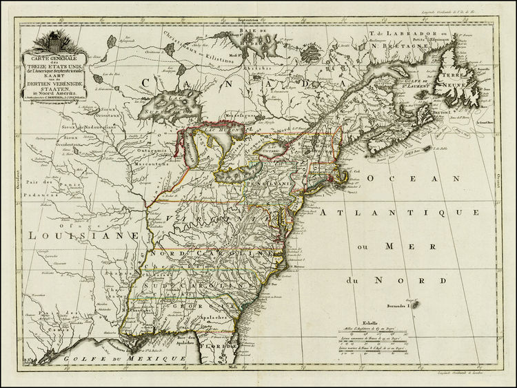
| title | Carte Generale des Treize Etats Unies de l'Amerique Septentrionale / Kaart van de Dertien Verenigde Staaten in Noord Amerika |
| maker | Mortier & Covens |
| date | 1782 |
| size | 40 x 55 cm. |
| condition | A fine impression. Good period outline color, very broad margins. Map has been stored for ages, folded in "4" thus created strong folds apart for the usual centre fold. Some surface dirt, but in all, a fine copy of a scarce map. Verso blank. |
| colouring | Fine period outline color |
| description | Rare Covens & Mortier map of the United States, one of the earliest appearances of a representation of an American Flag and one of the earliest maps to name the United States (in both French & Dutch).
The title cartouche refers to the thirteen United States in both French and Dutch and is decorated by an American flag with thirteen stars; thus this is one of the earliest maps displaying the stars and strips. The area mapped is from James Bay to the Gulf of Mexico and from the Atlantic coast to central Texas. |
| |  |
| price |  1.990 1.990 |
| Order or get more information |
 We accept: